Philadelphia Historical Commission Debuts New Interactive Map
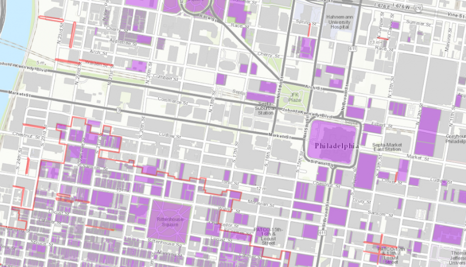
The new Philadelphia Register of Historic Places interactive map | Via the Philadelphia Historic Commission/PCPC
With all of the development around town these days, it’s helpful (and important) to know which properties are historically registered or if they sit within a special historical district. The Philadelphia Historical Commission launched the new Philadelphia Register of Historic Places interactive map on Friday, which should help make it easier to keep track of the thousands of historic buildings, structures, sites, objects, interiors, and districts registered in the city.
Previously, the information was readily available from the Commission’s office in City Hall, or online via two (rather clunky) PDF documents. Though the site is in beta form, the data is now compiled within an easy-to-use interactive map tool that allows users to search for or click on registered buildings, properties or objects to see their official address, the building’s name, when they were designated and also historical districts.
It’s incredibly easy to use, and we only wish the experience was slightly more robust, like providing some information as to why a district, place or object was deemed historic.
According to Hidden City, the map was created by the Streets Departments’s GIS Team under the guidance of the Philadelphia Historical Commission. Though it has launched, the map is not yet available on the Commission’s home page and may present some mistakes, as it is still “under review.”
- INTERACTIVE MAP [Philadelphia Register of Historic Places]
- Historical Commission Launches New Interactive Map [Hidden City]